 Loading...
Loading...
Loading...


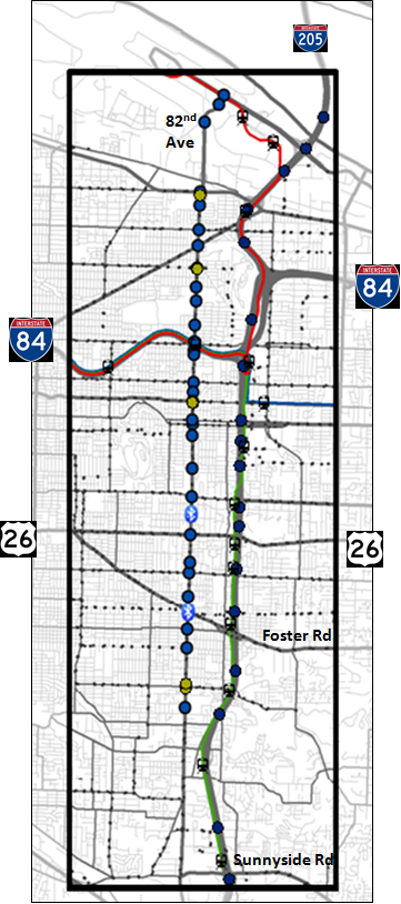
The Portland State University Multimodal Test Data Set submission contained on this web site consists of Freeway, Transit and Arterial data for the I-205 Corridor in Portland, Oregon. The selected corridor ranges along the I-205 Freeway from Sunnyside Road near milepost 14 to the end of the detection, near the Oregon/Washington State line. The corridor is approximately 10 miles long. The figure below displays many of the data sources that are included in the data set submission. The data set contains freeway loop detector data, weather data, incident data, arterial count data, signal phase and timing data, limited Bluetooth traveltime data and bus and light rail data. As shown in the figure, I-205 is the major north-south freeway in the corridor and 82nd Avenue is the primary north-south arterial. Transit service consists of busses running along and across 82nd Avenue and light rail lines that run along the I-205 freeway. This data set provides a two-month multi-modal data set for use in testing Connected Vehicle Applications.
this material is based upon work supported by the National Science Foundation under Grant No. 0236567, the Oregon Department of Transportation, the Transportation and Research Education Center, the Southwest Washington Regional Transportation Council, the Federal Highway Administration and by grants distributed through Metro. Any opinions, findings, and conclusions or recommendations expressed in this material are those of the author(s) and do not necessarily reflect the views of the funding organizations.